top of page


Newsletters
Am I allowed to use the login credentials of
another person to access the database?
Alligatorweed
(Alternanthera philoxeroides)
Found an invasive species? Register for a free login account, or submit a public report.
What is iMapInvasives?
Our Mission: Support Invasive Species Management

Management of multiflora rose (Rosa multiflora) - Photo credit: © Chuck Walla, SuAsCo CISMA
The mission of the Pennsylvania iMapInvasives program is to support the work of natural resource professionals by providing an online platform where invasive species sightings and management efforts can be recorded and shared. By providing data on invasive species distributions, the iMapInvasives program helps to facilitate both current and future endeavors to control and eradicate invasive species across Pennsylvania.
The iMapInvasives program works with non-profit groups, institutions, and state government to compile information on aquatic and terrestrial invasive species occurrences and treatments. Information is then used by countless organizations to prioritize invasive species control projects. In addition to natural resource professionals, tools in iMapInvasives can be used by citizen scientists, land owners, and others wishing to contribute their invasive species findings and view species distributions.
Focus on Pennsylvania

Administrators of the Pennsylvania iMapInvasives database are knowledgeable about invasive species that threaten the Commonwealth including high priority species and those species not yet found in Pennnsylvania but which are expected to arrive (early detection species). This key insight furthers collaboration with local entities and ensures that new invasive species findings are directed to the appropriate individual or agency in a timely manner.
The Pennsylvania iMapInvasives program is a member of the iMapInvasives Network, a group consisting of nine states and one Canadian province, each administering their own instance of the iMapInvasives database. Each participating state and province in the iMapInvasives Network is charged with serving the needs of individuals and organizations whose work focuses on tracking or managing invasive species.
Pennsylvania's iMapInvasives program is administered by staff from the Pennsylvania Natural Heritage Program (PHNP), a program crucial to protecting rare, threatened, and endangered species in Pennsylvania. Meet the administrators of the Pennsylvania iMapInvasives program by visiting the About Us page.
Early Detection & Rapid Response Tool

Hydrilla (Hydrilla verticillata) - Photo credit: Leslie J. Mehrhoff, University of Connecticut, Bugwood.org
The iMapInvasives database is uniquely designed to alert natural resource professionals when a new invasive species enters the state, when a species is reported in a designated area or region, or when a species is reported which a user has a special interest in or is managing for control or eradication purposes. These alerts, sent to a user's email address, can be customized by choosing a specific geography, individual or multiple species of interest, and a buffer distance from a predefined area.
The email alert system is a crucial tool in the effort to distribute information about new species detections and to aid in rapid response efforts. Many users of Pennsylvania iMapInvasives have already set up their own customized email alerts, enjoying the ease and speed at which they can be informed of a new invasive species sighting.
Prioritize Survey & Treatment Efforts
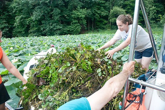
Water chestnut (Trapa natans) removal - Photo courtesy of Chesapeake Bay Program
Invasive species management efforts are conducted by a wide range of people and organizations across Pennsylvania. Very often, however, data is collected on species distributions but is not shared with similar organizations. With the tools available in iMapInvasives, individuals from various organizations are able to collaborate by contributing and utilizing data captured in iMapInvasives.
The "information sharing" capability available through iMapInvasives allows for the prioritization of management efforts, such as surveys and treatments, by reviewing data submitted by various individuals to the database. This capability promotes data sharing across organizational borders and increases opportunities for individuals and organizations to work together on priority management efforts.
By providing tools to analyze data gaps for species distributions, iMapInvasives provides a way to understand which areas require additional survey efforts or which species should be included in a treatment program.
bottom of page